Autori: D. Calderone, G. De Giorgio
Scarica l’articolo in formato .pdf: Archaeology and geomorphology of an area: new interpretations of long-term settlement logics from Prehistory to the Byzantine period across the central-eastern slopes of the Etna volcano
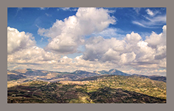
 L’analisi archeologica dei territori siciliani compresi tra la costa ionica e le pendici centro-orientali dell’Etna ha storicamente rappresentato una sfida per gli archeologi. Per molto tempo si è ritenuto che l’interpretazione dei dati archeologici fosse completamente compromessa dalla natura paludosa delle aree costiere, dall’intensa attività umana nel tempo e dall’impatto di numerose colate laviche, soprattutto nelle aree più elevate come il comune di Mascali (CT), insediamento distrutto dall’eruzione del 1928. Questo studio affronta queste sfide, combinando le evidenze archeologiche esistenti con lo studio della geomorfologia e della geologia dell’area, in particolare la sovrapposizione dei vari insediamenti nella regione dalla preistoria alla tarda antichità, per far luce su come le diverse comunità umane abbiano abitato la zona nei secoli. La combinazione di informazioni provenienti da contesti archeologici noti con lo studio geomorfologico del paesaggio permette di comprendere più a fondo il rapporto tra l’uomo e il suo ambiente. La presenza di siti archeologici in corrispondenza di specifiche formazioni geologiche, come i depositi essenziali di argille blu, chiarisce la relazione tra risorse naturali, insediamenti, viabilità e porti. Questo, a sua volta, permette di formulare nuove ipotesi sullo sfruttamento del territorio, con particolare riferimento al periodo romano e bizantino, evidenziando i forti legami tra quest’area della Sicilia e quelle più a Nord, in corrispondenza del porto di Naxos (moderna Giardini-Naxos, ME).
The archaeological analysis of Sicilian territories between the Ionian coast and the Etna central-eastern slopes has historically posed challenges for archaeologists. For a long time, it was believed that the interpretation of archaeological data was completely compromised by the marshy nature of the coastal areas, intense human activity through time, and the impact of numerous lava flows, especially in higher altitude areas like the municipality of Mascali (CT). This town was destroyed in the 1928 eruption. This study addresses these challenges by combining the extant archaeological evidence with the study of the geomorphology and geology of the area, especially the superimposition of the various settlements in the region from prehistory to Late Antiquity to shed light on how different human communities inhabited the area over the centuries. Combining information from known archaeological contexts with the geomorphological study of the landscape makes it possible to gain a deeper understanding of the relationship between humans and their local environment. The presence of archaeological sites in correspondence with specific geological formations, such as essential deposits of blue clays, elucidates the relationship between natural resources, settlements, roads, and ports. This, in turn, enables the formulation of new hypotheses regarding the exploitation of the land, with particular reference to the Roman and Byzantine periods, highlighting the strong links between this area of Sicily and those further North, in correspondence with the port of Naxos (modern Giardini-Naxos, ME).