
Author: R. Brancato
Download article as .pdf: Paesaggio rurale ed economia in età ellenistica nel territorio di Catania (Sicilia orientale)
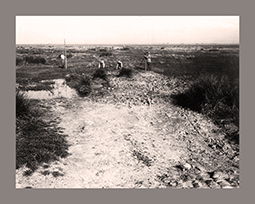 Paper’s aim is to outline the main developments in settlement organization in the Plain of Catania throughout the Hellenistic period: on the basis of the new available archaeological map, it is possible to attempt to fill our knowledge gap on “peripheral landscapes” of Eastern Sicily. A systematic research on the rural landscapes of the Plain of Catania started in 1996 when a series of topographic surveys were carried out according to the Forma Italiae Project’s methodology. Mostly covering the western portion of the plain of Catania, due to their unexploited potential, these topographical surveys are of great interest for any attempt at analysing rural landscapes and routes and road networks in antiquity: within the survey area (425 kmq) 132 archaeological sites were identified, dating from the Neolithic to the Medieval period. Together with the existing amount of legacy data available from eastern Sicily, the survey data were stored in the Ru.N.S (Rural Networks in Sicily) database. The results obtained through the use of the Ru.N.S database provide a vivid image of rural population trends in Hellenistic Sicily, and may help in reconstructing the organization of the rural landscapes throughout the transition from the Greek to the Roman period.