Author: F. Giletti
Download article as .pdf: La cloaca della valle stabiana a Pompei: struttura, funzione e cronologia di un apparato del sistema di smaltimento delle acque meteoriche e reflue della città tardo-sannitica e romana
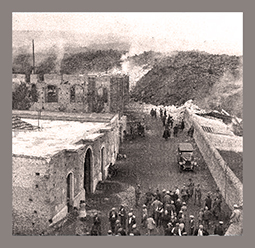
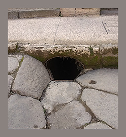 The study of the disposal system of Pompeii, and especially of the central-southern sector of the city, has shown the strong complementarity between the urban plan and the wastewater regulation. These aspects are strongly integrative and essential to the functioning mechanisms of the city itself. In the diachrony of the urban development of the city, the attention for the regulation and disposal of waters always remains one of the prerequisites of the urban and architectural evolution of Pompeii. The best solution to this need is reached starting at the end of the II century B.C. During a wide program of building renovation of the entire urban space of Pompeii, complex underground conveyance systems, functional to the extra moenia evacuation of waters, are built. In such a framework, the most eloquent and most illustrative artifact turns out to be the wide collector of the Stabian valley. For the first time we present here both an overall historical-archaeological study and a systematic analysis of the structure and its annexes, starting from its inception, along the via dell’Abbondanza, to the point of evacuation, identified between the Quadriportico dei Teatri and the Foro Triangolare.